Poverty Point Bridge
J Cunningham
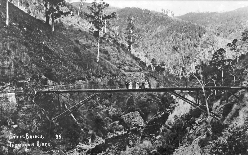
The Walhalla Tramway Bridge, known locally as The Old Steel Bridge or Poverty Point Bridge, spans the Thomson River approximately 3.3km upstream of the road bridge over the Thomson River on the Erica – Walhalla Road. (The bridge is located in the EricaSites layer of this Map.) The bridge is 52m long, varies in width between 1.8m at each end to 1.2m in the centre with the deck 12.8m above the riverbed.

Poverty Point Bridge
Ca. 1900
Source: FCRPA
Walhalla Gold
Alluvial gold was discovered in Walhalla in 1862, but in 1863 the immensely rich Cohens Reef was discovered just above the creek and underground mining commenced. Mining machinery and associated ore crushers were all driven by steam generated by wood-fired boilers. As the mines expanded increasing quantities of firewood and mining timbers were required. The wood was harvested from surrounding hills and transported to the mines on narrow gauge horsedrawn tramways.
Tramways
By 1899 the mines were consuming approximately 38000 tonnes of timber every year. The tramway network to supply the ever increasing wood requirements lead to an extensive network of tramways extending throughout the surrounding hills. One extension included the construction of a bridge over the Thomson River at Poverty Point to access wood on the western side of the river via a 11km long 0.6m wide horse drawn tramway.
Italian Camp
Many of the woodcutters and splitters had immigrated from Italy and developed a community at Walhalla. This community made a substantial contribution to the development of Walhalla working a number of jobs, including mine manager, wood cutter and splitter, farmer, miner and mine labourer, merchant and builder. The wood cutters and splitters would set up camp in bark huts close to the area they were working, and it seems they rarely came into town. Around the turn of the century several of these families took up land at a remote station along the Thomson River, which was called Poverty Point.
Bridge Design, Manufacture and Construction
The design of the bridge is attributed to Thomas Timmins. Timmins was an assistant engineer at the Victorian Railways from 23 May 1889 to 31 May 1898. Records of membership of the Victorian Institute of Engineers show him as a member in 1908 with a reference to Dorman Long, a bridge fabricator, as his employer. The bridge is a prefabricated steel structure consisting of steel girders with rivetted tubular steel vertical and diagonal struts with a timber deck. It was manufactured in 1900 for the Long Tunnel Mining Company by Dorman Long (London, England) and transported to Australia. Site works and construction were undertaken by Austral Otis Co (South Melbourne), with construction completed in June 1900.
Significance
"The Tramway (Poverty Point) Bridge at Walhalla is historically and architecturally significant to the State of Victoria.
- The bridge is historically significant as an important reminder of the gold mining industry of Gippsland, and for its role in serving the Long Tunnel gold mining company mine at Walhalla.
- It was used to bring mining timbers and firewood for the mine's boilers and furnaces and is therefore also significant for its role in the development of the mining town of Walhalla.
- The bridge is architecturally significant as a unique and essentially intact example of a bridge of its type constructed in Victoria. It is unusual in being constructed of imported prefabricated steel at this time since bridges of this size were typically constructed of timber trestles."
(Source: Victorian Heritage Database)
Maintenance and Repair
Following progressive closure of the mines, the last major mine closing in 1914, use of the tramway system and the bridge for firewood and mine timbers ceased. The timber deck was later destroyed by a bushfire, probably in 1939.
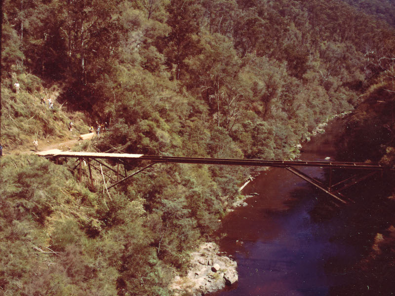
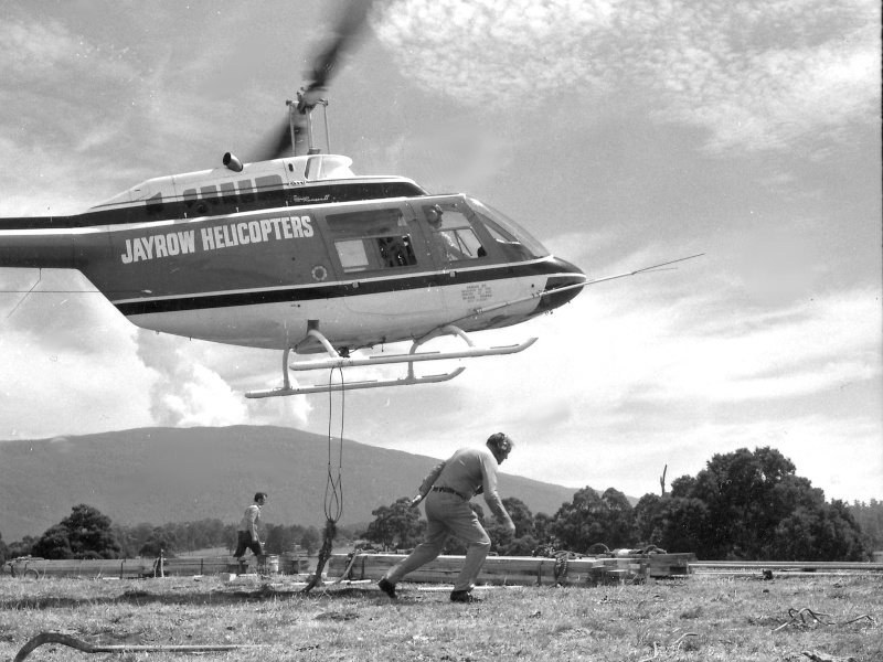
In March 1976 the FCV redecked the bridge thus reopening it as a river crossing for the Alpine Walking Track which runs from Walhalla to Canberra. The timber for the deck was lifted onto site by helicopter with smaller items such as hand tools, creosote and bolts being carried in by the works crew.

New Decking by FCV Underway
1976
Source: FCRPA

Erica FCV Crew Loading Helicopter
1976
Source: FCRPA
There are more photos in a gallery on this page.
In the mid-1980s repairs and redecking were undertaken by the National Parks Service. Approximately 50% of the timber decking which had rotted out since 1976 was replaced.
By 1998 responsibility for management of the bridge had passed to Parks Victoria. By this stage the bridge was in poor condition and it had been closed to pedestrians. A comprehensive structural and corrosion assessment of the bridge was undertaken in 1999 to determine the current condition of the bridge and required works for its longer term preservation. This assessment determined that the bridge structure was currently close to the limit of structural adequacy, and would need to be closed if not upgraded within the next year. The assessment further concluded that the structure was well below the original design capacity, although probably adequate for pedestrian traffic provided repairs to the decking and structure were carried out.
Funding for further investigation including design and specification was provided in 2000/2001.
Works included:
- Removal of vegetation around the ends of the bridge and excavation to expose all footings.
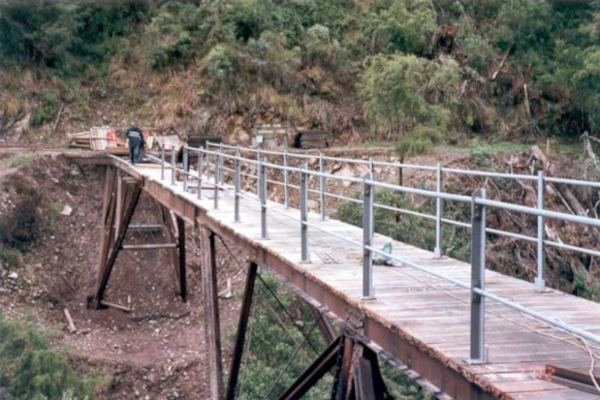
- Replacement of decking and hand rails. During excavation of the footings an original handrail stanchion was discovered. This was used as a template for the fabrication of new stanchions for the replacement handrail.
- Treatment of corrosion on girders and struts.

Poverty Point Bridge - Near Completion
2002
Source: J Cunningham
Works were undertaken by Churchill Maintenance and Fabrication Pty Ltd, a Latrobe Valley contractor. The contract was awarded in October 2001 and work was completed in July 2002.
