
Early Remote Sensing for Fire Suppression
R Rawson
The use of Infra-red technology in aircraft to map wildfires had been considered since the 1960's, with a report on the technology prepared by Athol Hodgson in 1966.
My memory is we first tried a line scanner in 1981/82 on a fire near Kilmore/Wallan - It was owned by CSIRO and operated from a Fokker F27 that was either owned by or leased by CSIRO. I don't remember a real time image being available in the aircraft.
In 1982/83 this same set up operated on the East Warbuton fire of 16 February 1983, and it uncovered a massive unburnt area that was not understood by fire planners. It assisted fire control line placement from that time.
The big push came in 1984/85 with the NSCA - as usual - providing top line equipment at bargain basement prices. (Fig. 1) It was used extensively over the North East fires and provided real time print outs that were interpreted onto maps in-flight by Bruce Dymond and Kevin Ritchie, and the maps were then, when necessary, dropped in tubes onto locations where they could be accessed by the teams managing the fires.
In the early 1980s the FCV also purchased a FLIR unit to help with mop-up and other fire operations. (Fig. 2)
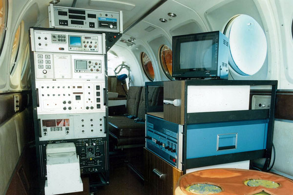
Fig.1 NSCA Line Scanner in Beechcraft King Air
About 1983
Source: B Rees
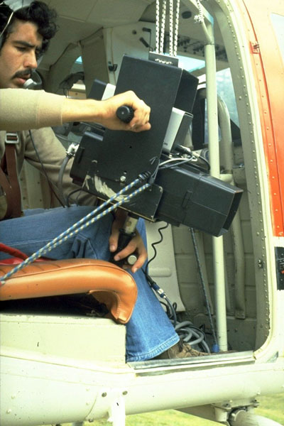
Fig.2 Bryan Rees with the first FCV FLIR- in a Jayrow Bell Jetranger
1981
Source: B Rees